
Walk a Rocky Mount Street by Address
A street search begins with the parcel, not a claim about who is there now. Rocky Mount spans Nash and Edgecombe counties, and a mailing city does not settle which county keeps the tax account or deed. Enter the address in the appropriate county property search. Capture the situs address, parcel or PIN, legal description, current owner, deed book and page, and recording date if available. Those details let the same lot be followed even when an older record uses a subdivision, a lot number, or a different street form.
- Use the address in Nash Tax Search or the Edgecombe Parcel Search, after confirming the county with the parcel or map.
- Save the parcel identifier, legal description, current owner and deed book/page as dated record notes.
- Open the county deed index and follow the prior book/page reference backward through the conveyances.
- Use a voter record only as a dated registration clue, then compare county, status, precinct and address with the parcel trail.
- For an older address, compare the directory street or householder section with maps and deed descriptions.
Each step answers a narrower question. The assessor links an address to a tax parcel, the deed index records a transaction, and a directory can show a person listed at an address in one edition. None of those records, alone or together, proves a continuous or current household. Note: Write down whether a name is an owner, grantor, grantee, listed householder, or registered voter.
Choose the Rocky Mount County Side
The first fork in a Rocky Mount street directory search is Nash or Edgecombe. The city is in both counties, while the county seats and their record offices are in Nashville and Tarboro. Use a parcel PIN, legal description, GIS parcel boundary, polling-place context, or deed reference to choose the custodian. A USPS postal city and ZIP help normalize mail, but they do not establish a parcel boundary or county custody.
Nash records route through the Nash County Register of Deeds; Edgecombe records route through the Edgecombe Register of Deeds and its certified-date table. The county line has a local history too: city planning material identifies the railroad tracks as the official county boundary in 1871. That makes rail-corridor and historic-address research especially dependent on the parcel and deed description.
Rocky Mount Street Directory Search Fields
The two property systems do not expose the same fields. Nash Tax Search offers owner, address, parcel ID, PIN, advanced, and tax-bill routes. Its advanced screen requires at least one criterion and permits multiple comma-separated values without spaces, although the precise dynamic criteria were unavailable during the research inspection. Edgecombe exposes address and owner routes alongside parcel and deed-reference fields. Keep the original query with the result date so a later search can be repeated.
| Portal field | Form | Search use | Important limit |
|---|---|---|---|
| Nash owner or address | Search tab | Find a tax account by name or situs | Exact required format was not available during maintenance |
| Nash parcel ID or PIN | Search tab | Return to one identified parcel | Nash PIN format was not documented in the reviewed sources |
| Edgecombe Property Address | Text field | Find the situs parcel | It is not a household field |
| Edgecombe Current Owner | Text field | Find the present tax owner | Owner address is a separate field |
| Edgecombe Deed Book/Page | Text field | Join the parcel to a recorded instrument | Confirm the instrument in the ROD record |
| Edgecombe GIS map extent | Map filter | Restrict a result set to the displayed area | Map service layers can be temporarily unavailable |
A view of the Edgecombe parcel search shows the address, owner, parcel, and deed-reference routes used in this part of the Rocky Mount street directory.
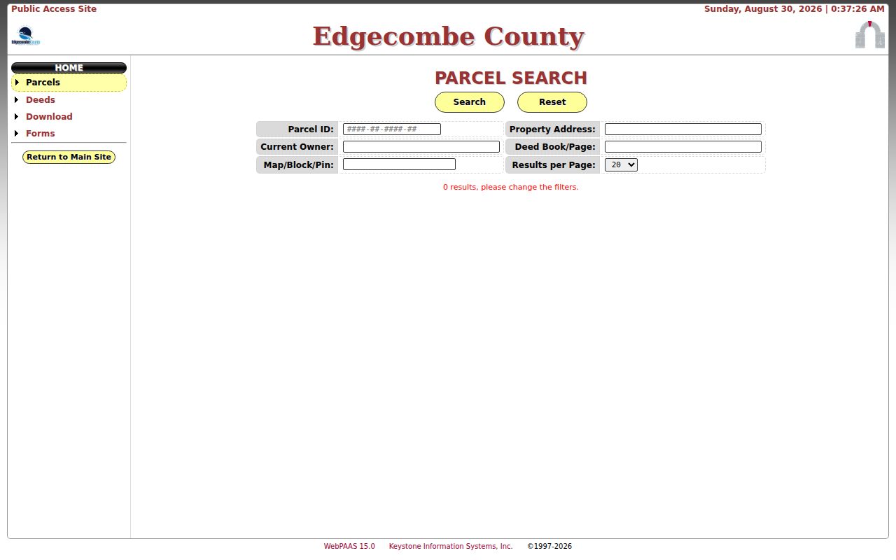
The parcel form is useful for locating a record, but its current-owner field should be reported as a tax ownership field rather than a statement of residency.
Browse a Rocky Mount Block in GIS
Edgecombe GIS supplies Owner Name, Parcel PIN, Street Address, Deed Reference, and Account Number searches. It also offers deed-date, value, acreage, subdivision, zoning, tax-code, and sale-price filters, plus a filter for the current map extent. Select and identify tools, measurement, printing, Street View, and CSV export can help build a working list of parcels along one short stretch. Verify every selected parcel back in the assessor and deed records.
The Edgecombe GIS map service is the best documented map-based route for this task.
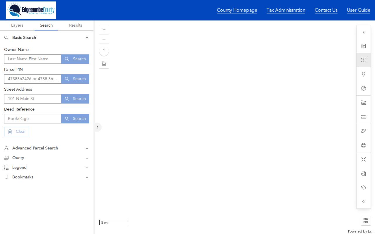
Use geometry to tell adjoining parcels from lots merely across the road or nearby. The map is a parcel tool, not an occupant list.
Nash GIS provides 9-1-1 addressing, maps, data, and analysis through its MapViewer. The reviewed browser received an unsupported-browser notice, so its live search fields and layers need checking at the time of use.
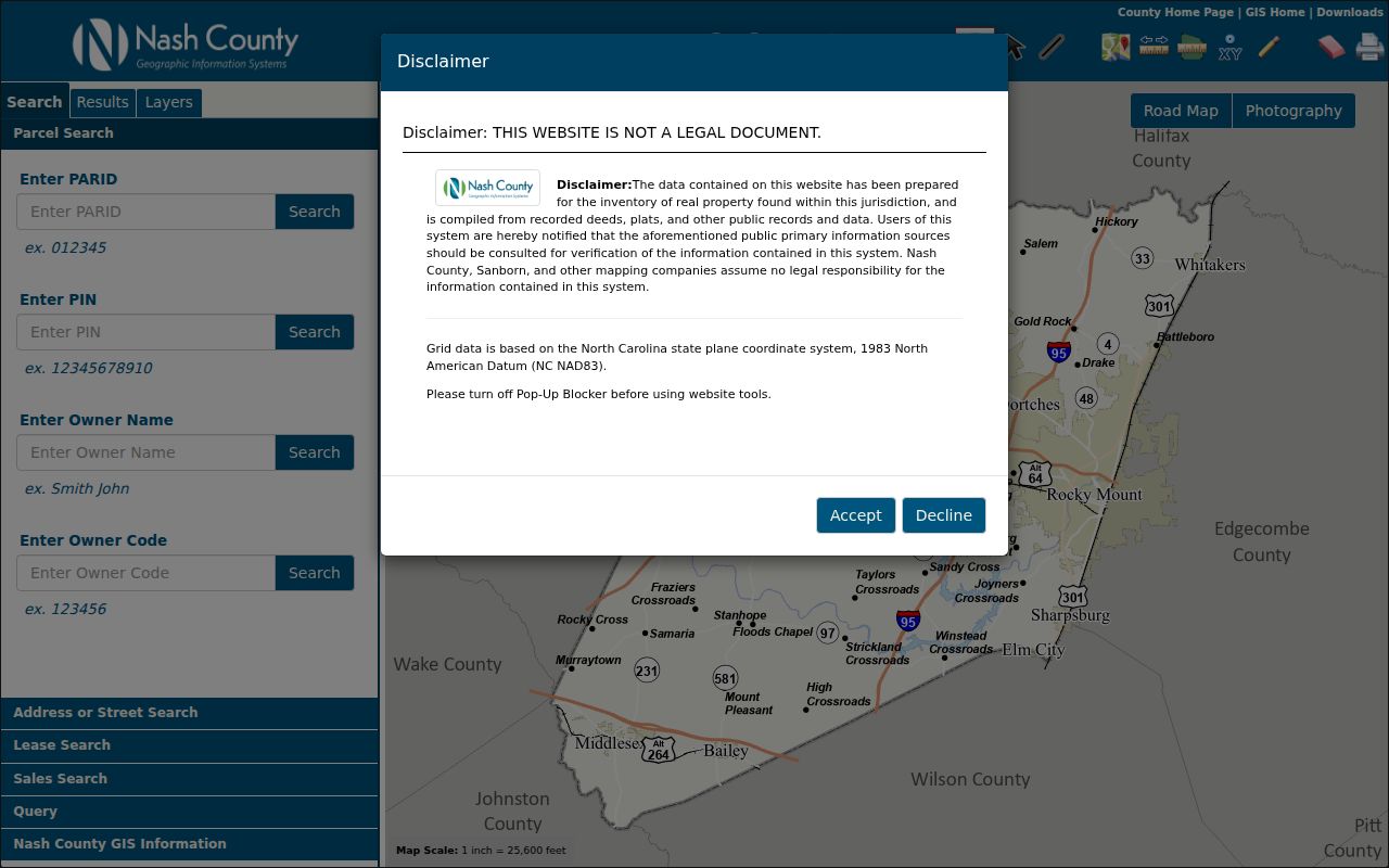
That access limit is a reason to retain the parcel number and contact Nash GIS for live-viewer help when the online map does not load.
Rocky Mount Street Records by Address
Address-keyed records answer different questions. A tax card anchors the parcel. GIS locates the lot among nearby parcels. A deed traces ownership and legal description. A voter record gives a dated registration signal for an individual, while a city permit can identify an applicant, owner, contractor, and work status. Older street and householder sections can add a historical listed-at address. Read the field label before assigning a person a role.
| Address record | What it can show | Access route | What it cannot establish |
|---|---|---|---|
| Nash Tax Search | Owner, address, parcel ID, PIN, tax routes | Current online portal | A complete household list |
| Edgecombe Parcel Search | Property address, owner, deed book/page, values and acreage | Parcel, deed, and download tabs | Every person connected with the address |
| Edgecombe GIS | Parcel geometry, address, PIN, owner, deed and map tools | Current dynamic map service | Legal survey proof or occupancy proof |
| ROD deed or plat | Parties, legal description, book/page and chain | Nash guide or Edgecombe Cott route | Where a seller went next |
| Voter search or file | Ordinary public registration fields and election context | NCSBE Voter Search or published files | Presence at the address on every date |
| Directory street section | Address-to-householder clues for a dated edition | Braswell and digital directory holdings | Current status or continuous occupancy |
Rocky Mount’s Citizen Self-Service route is the city channel for permits and customers. Permit and inspection details are property-process records, not proof that an applicant lived at the site. Note: Give an office the county, address, parcel/PIN, book/page, date range, and record series when requesting help.
Read Rocky Mount Situs and Mail Fields
Situs means the physical location of a parcel. A tax mailing address is where notices go. Edgecombe deliberately displays Property Address, Current Owner, and Owner Address as separate values. The mailing field may point to a post office box, a trust, an attorney, a business office, or an address outside Rocky Mount. A name in that field supports only a statement such as “tax record mailed to,” not a conclusion that the person lived at the parcel.
- Parcel
- A defined piece of land in the tax and mapping system, usually tied to a parcel ID or PIN.
- Situs address
- The physical property address used to locate the parcel, distinct from the address used for tax mail.
- Plat
- A recorded map of a subdivision or lot layout. Nash directs plat searches to its Book/Page tab.
- Criss-cross directory
- An address-to-name directory arrangement. Rocky Mount has a confirmed 1963 householder and street guide, but no separate complete criss-cross run was confirmed.
USPS ZIP Code Lookup can standardize a delivery address, city, and ZIP. USPS says its result does not confirm a person or company at the address, and postal labels do not decide a county or municipal boundary.
Follow Rocky Mount Deed References
Once the parcel card supplies a deed book/page, read the recorded instrument rather than stopping at the tax result. Save grantor and grantee names, execution and recording dates, consideration if shown, legal description, prior reference, easements, and restrictions. Move backward through the prior book/page whenever it appears. A street number can change, but a lot, subdivision, acreage, and metes-and-bounds description can keep the search on the same property.
Nash deed-index instructions divide the online route at 1970: Books 874 forward use the 1970-to-present index guidance, while Books 873 and back use the prior-to-1970 online books. All Nash plats use Book/Page. The Cott portal itself was not available for full field inspection, so do not assume it offers the Edgecombe form fields.
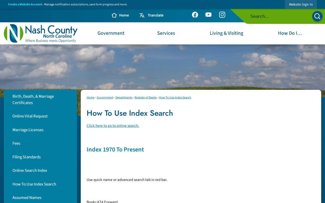
The guide provides the needed branch before a name or book/page search, while the Register of Deeds remains the controlling office for official records.
The Edgecombe Cott entry route offers guest access or login, but its live search fields were behind that flow during inspection.
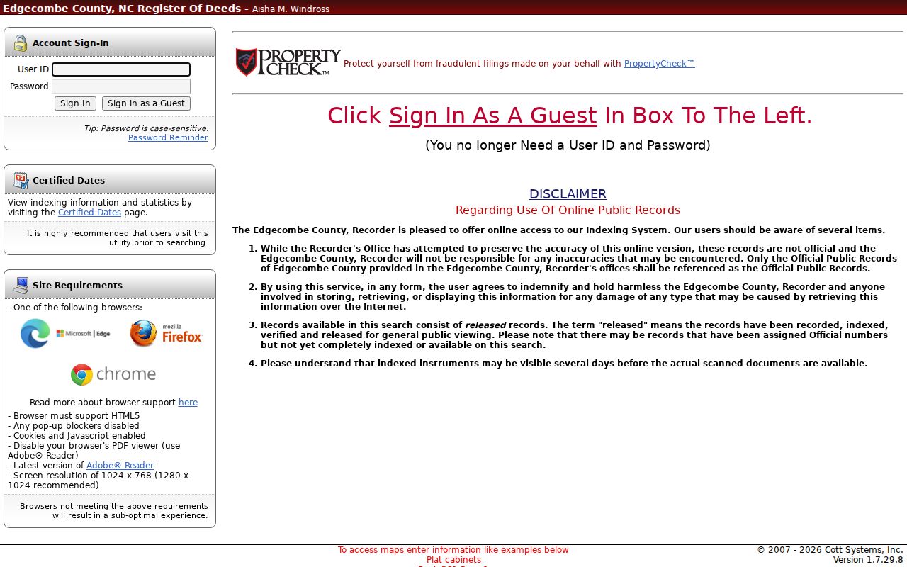
Edgecombe warns that indexed or released records can appear before images, and the official office record controls if an online item conflicts.
Use the Rocky Mount Street Directory Era
For a historic address, the key breakpoint is 1930. The surveyed directory record identifies that year as Rocky Mount’s first street-address listing. Earlier directories can still help with a name or business, but they may not yield a street number. The 1963 Hill’s Rocky Mount Edgecombe/Nash volume has a Directory of Householders plus a street-and-avenue guide. It lists numbered streets numerically, named streets alphabetically, addresses numerically, and a householder or concern opposite the address.
Record the edition and page, then compare the entry with a deed and tax record. A listed householder is not necessarily the deed owner, and the directory’s notation may describe a home, rooming address, office, or business. The fuller collection history and access points are on the Rocky Mount Directory Book page.
Map Rocky Mount Streets Before Parcels
The four-sheet 1896 Rocky Mount Sanborn map set can place a building, street, sidewalk, or property setting before modern PINs and ZIPs. Rocky Mount sheets exist for 1885, 1891, 1896, 1901, 1907, 1912, 1917, 1923, 1949, and 1956. These are insurance maps, not ownership or occupancy lists, so use them to compare physical setting with a later deed or directory rather than to name a resident.
Annexation adds another date-sensitive layer. The city’s annexation process requires metes and bounds, a survey map, PIN, and ownership proof. A 2018 annexation map example joins deed book/page, map book/page, acreage, township, tax parcel, and Eastern Avenue. It shows why a map record can clarify a boundary without becoming evidence for any unrelated address.
Limits of a Rocky Mount Street Directory
A Rocky Mount street directory is a trail of differently dated roles, not a roll call. Voter search is name-first, not street-only. Its public result is a registration record and not proof of physical occupancy on every date. The public voter system protects full and partial Social Security numbers, full dates of birth, driver-license numbers, email, ID copies, and other protected fields under G.S. 163-82.10. Address Confidentiality Program participants can have a substitute address under Chapter 15C.
Lawful personal use. Use address records for family history, estate questions, civic research, or property curiosity. Do not use a name, address, or map result to stalk, harass, intimidate, or harm anyone.
When the question changes from a street to one identified person, a Rocky Mount resident lookup requires separate name-based verification and the same care with dated roles.