
Rocky Mount ZIP Code Coverage
The confirmed Rocky Mount ZIP code references are 27801, 27802, 27803, and 27804. They are postal clues, not parcel maps. The official USPS material ties some labels together for routing purposes, while post-office locations offer useful service-area leads. Use an exact-address result for a mailing label. Then use the tax or GIS systems to identify the parcel and whether the record belongs in Nash or Edgecombe County.
| ZIP | Areas covered | Post office | Notes |
|---|---|---|---|
| 27801 | Central and east Rocky Mount postal lead | Rocky Mount Post Office, 327 E Raleigh Boulevard | Does not establish city or county boundary. |
| 27802 | Rocky Mount routing label | PO Box-oriented postal clue | Exact delivery-type breakdown was not located in official USPS material. |
| 27803 | West Rocky Mount postal lead | West Rocky Mount, 1033 Hammond Street | USPS routing material pairs its label with Rocky Mount 27801 information. |
| 27804 | South and west postal facility lead | Rocky Mount Annex and Westridge locations | USPS routing material pairs its label with Rocky Mount 27804 information. |
ZIP 27815 is sometimes repeated on nonofficial ZIP pages, but it was not confirmed in the USPS sources reviewed. It is not part of this directory until a current USPS address or city search confirms a particular use. The regional ZIPs 27809, 27822, 27856, 27864, and 27886 appeared in a transportation survey, not as a Rocky Mount city inventory.
Verify Rocky Mount ZIP Codes
USPS ZIP Code Lookup offers three useful modes: address lookup, city-and-state lookup, and cities by ZIP. The address form makes street required and allows an optional company, apartment or suite, city, state, and ZIP. USPS says its result does not confirm an actual person or company at an address. It is a postal-format check, not a way to identify an occupant.
| Street | Required in the by-address search. |
|---|---|
| Apartment or suite | Optional; it can resolve multiple matches. |
| City and state | Required for the city-and-state mode. |
| ZIP | Required for the cities-by-ZIP mode and optional in the address mode. |
| Company | Optional in the address mode. |
The USPS lookup screen is shown below. Copy the address formatting it returns, then search the relevant county portal by property address or parcel identifier. That order avoids treating a postal label as a record-custody decision.
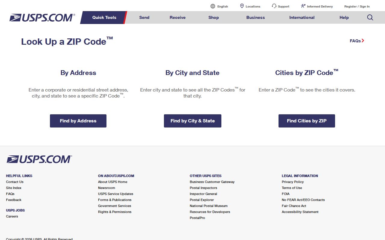
A successful USPS result can normalize an address for a mail request, but the county parcel record remains the better source for the property and county connection.
Rocky Mount ZIP Code Postal Clues
The Rocky Mount Post Office listing gives a 27801-9998 address at 327 E Raleigh Boulevard. USPS also identifies West Rocky Mount at 1033 Hammond Street with 27803-9996, the Rocky Mount Annex at 2451 Postal Drive with 27804-9996, and Westridge at 3695 Sunset Avenue with 27804-9995. These are official locations, not borders for the ZIP code directory.
The Rocky Mount Post Office record appears below. Postal-facility ZIPs and nearby delivery labels can differ from an exact address result, so the full address and unit should always control the final mailing format.
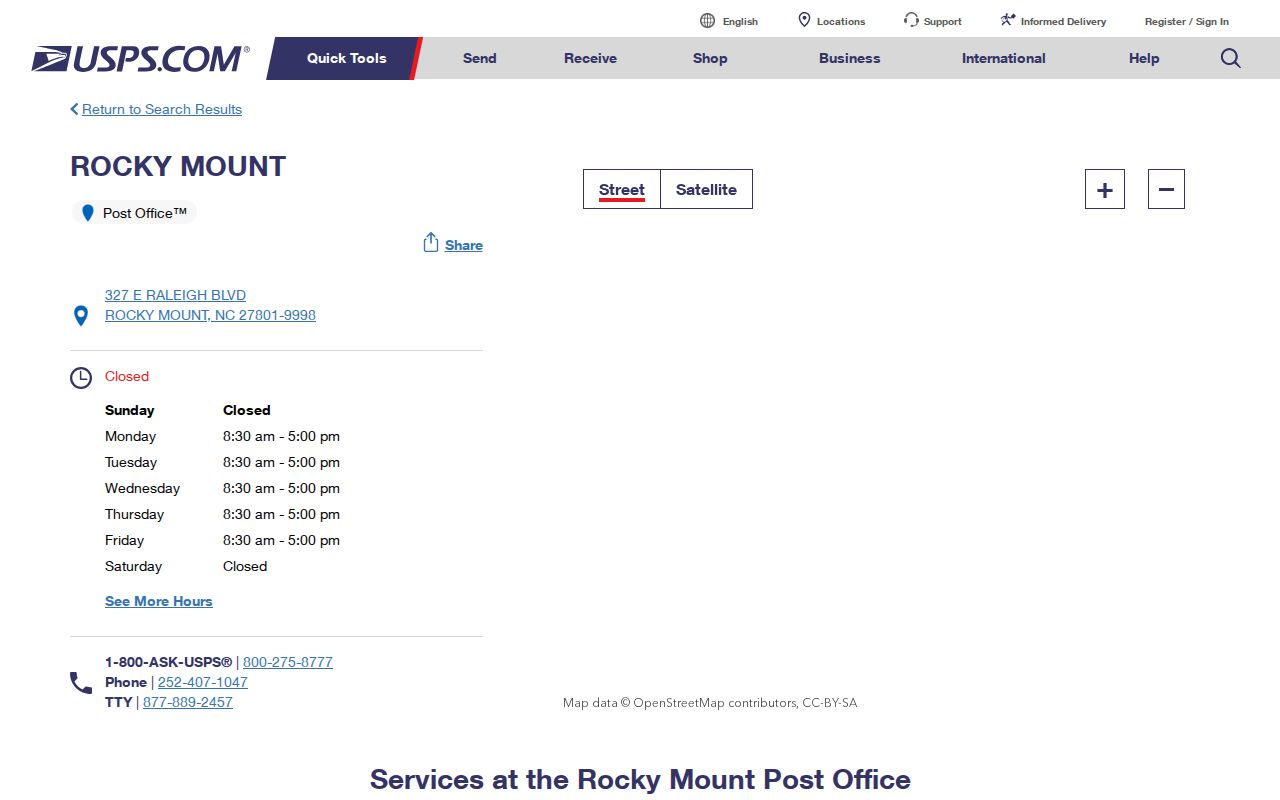
The listing supports a post-office contact or service lead. It does not show the people, parcels, municipal limits, or county boundary associated with every address sharing the label.
Search a Rocky Mount ZIP Code
A ZIP-based search should be a sequence of checks rather than a list of presumed residents. Rocky Mount crosses both Nash and Edgecombe counties, and the city is the county seat of neither. Use the parcel record, legal description, or GIS map after USPS normalization. The county step is essential because a Rocky Mount mailing city alone does not identify the Register of Deeds, tax office, or clerk that holds the related records.
- Enter the complete address in the USPS lookup and keep the returned city, state, ZIP, and unit format.
- Search the Nash Tax Search or Edgecombe Parcel Search by the property address, owner, parcel ID, PIN, or deed book and page as appropriate.
- Confirm the county with the parcel and GIS result before using a deed, court, or tax record.
- Check a city-limit, ETJ, or annexation map when municipal jurisdiction matters.
- Date any precinct or polling-place clue to the election cycle that produced it.
There was no confirmed live ZIP filter in the county property portals. Nash's advanced interface supports multiple comma-separated values for its criteria, but the exact criteria list was unavailable during maintenance. Edgecombe's download page shows no visible ZIP field, so use address, map sheet, owner, or parcel fields and verify the ZIP with USPS.
Rocky Mount ZIP Codes and City Limits
A ZIP code is built for postal routing. It does not define Rocky Mount municipal limits, an Edgecombe or Nash parcel, or the city's extraterritorial jurisdiction. The postal city can include addresses beyond the city boundary and across the county line. The historic planning material also describes the 1871 railroad tracks as the official county boundary, a local reason to verify a parcel rather than rely on a familiar mailing city.
Boundary check. A USPS label confirms delivery formatting, while the parcel and GIS record identify the physical property and county record trail.
- ZIP Code
- A USPS routing label used to sort and deliver mail.
- ZIP+4
- An added delivery segment that can narrow mail routing; it is not a parcel or municipal identifier.
- PO Box ZIP
- A postal label associated with box-oriented service. It should not be assumed to describe a street-delivery area.
- ZCTA
- A Census ZIP Code Tabulation Area, a statistical approximation rather than a USPS delivery boundary.
- Carrier route
- A postal delivery grouping, not a public roster or a county jurisdiction line.
Census Gazetteer materials use ZIP Code Tabulation Areas for statistical geography. A ZCTA can be helpful when comparing broad data, but it is not the USPS delivery boundary and it is not a Rocky Mount parcel boundary. State the geography being used before comparing a postal label with city, county, or census information.
Match Rocky Mount ZIP Codes to Parcels
Nash Tax Search provides owner, address, parcel ID, PIN, advanced, and tax-bill search routes. Edgecombe Parcel Search accepts parcel ID, property address, current owner, deed book and page, and Map/Block/PIN. On the Edgecombe side, the detail record separates Property Address, Current Owner, and Current Owner Address, which helps prevent a mailing destination from being mistaken for the parcel location.
Edgecombe GIS also searches owner name, parcel PIN, street address, deed reference, and account number. Its map tools can filter by current map extent and export a CSV. The data are useful for locating and comparing parcels, but an assessor field is an ownership or tax-administration signal, not a directory of who is currently at the address.
When a ZIP narrows the search to a particular street, the Rocky Mount street directory lookup is the better route for the address-keyed record chain.
Rocky Mount ZIP Code Election Geography
ZIP and precinct are separate geographies. The North Carolina voter lookup searches by first name, last name, optional middle initial, optional year of birth, optional county, and a required status selection. It can provide registration and election context, but no street-only mode was visible. A voter result is not proof of continuous physical presence, and protected identifiers are not public fields.
Nash's Rocky Mount-area polling list includes P16 Battleboro, P17 Benvenue, P18 Hunter Hill, P19 Winstead, P20 Sunset, P21 Downtown at Braswell, P22 Edwards, P23 South, and P24 Sharpsburg. The 2026 county page calls Hunter Hill new and says Sharpsburg will change later that year. Keep the election year with any precinct clue, because polling assignments can change without a postal-boundary change.
Note: Precinct and ZIP references describe different systems, so neither should be substituted for the other in a property or record search.
Rocky Mount ZIP Code Routing Changes
The December 11, 2014 USPS Postal Bulletin documents a Rocky Mount 27803 and 27804 label-routing change. It is a useful reminder that a routing-label update is not evidence that a parcel moved, a county changed, or the city expanded. The DMM label file similarly pairs 27801 and 27803 with Rocky Mount 27801 label information, while 27802 and 27804 pair with Rocky Mount 27804 information.
For an older address, postal ZIPs may not exist at all. The Rocky Mount city-directory survey identifies 1930 as the first confirmed street-address directory year, and the Sanborn map sequence covers 1885 through 1956. Compare the street guide, map, legal description, and current parcel rather than retrofitting a current ZIP to a historic source.
Rocky Mount ZIP Code Access Routes
Use USPS online for address, city-state, or ZIP lookup; a local post-office listing for service information; county tax and GIS portals for the property and county; and the city annexation records where municipal context matters. The city annexation process requires metes and bounds, a survey map, parcel identification, and proof of ownership, all of which illustrate why the postal label alone is incomplete.
For a records request, name the county, property address, parcel ID or PIN, date range, and record series. North Carolina's Public Records Law supports access to existing public records, but an agency does not need to create a new resident compilation. Keep city, county, parcel, and postal labels distinct throughout the request.